Datasets
The data used in this course is available for download at data.inasafe.org. Ask your trainer what data you will need to download for the course, if it is not provided.
If you are working through the training independently, use the following data packages:
Hazard data
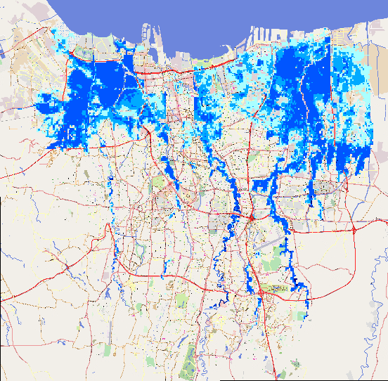
Flood Model
|
Jakarta_Flood_HKV_WGS84.tif |
|
A flood similar to the 2007 Jakarta event |
|
Raster |
|
Continuous |
|
Single event |
|
metres |
|
HKV |
|
|
|
2012 |
|
|
|
Jakarta |
|
The flood model was created by scientists/engineers in coordination with DKI Jakarta Public Works based on the 2007 flood conditions. The water depth is the maximum depth occurring across the entire flooding period. |
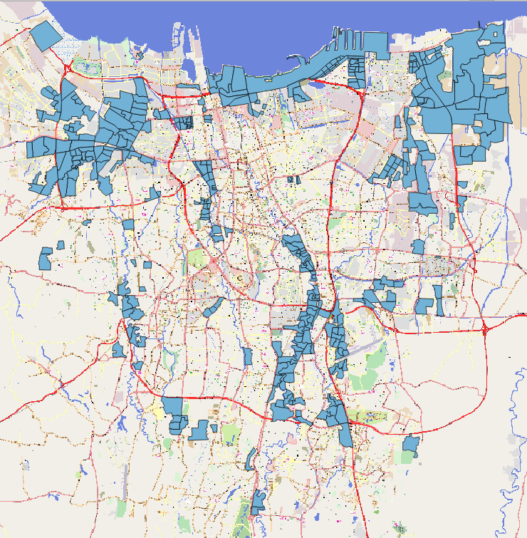
Flood Footprint
|
Jakarta_Flood_18113_WGS84.shp |
|
A flood in Jakarta like 2013 |
|
Polygon |
|
Classified |
|
Single event |
|
FLOODPRONE |
|
Wet (Yes), Dry (No) |
|
OSM and BPBD DKI Jakarta |
|
18 January 2013 |
|
|
|
Jakarta |
|
Along with sub-village boundaries that were mapped during the DKI mapping project, this dataset was used to identify flood areas based on information provided by the villages. |
Earthquake
|
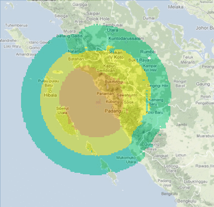
Padang_EQ_2009_WGS84.tif |
|
Earthquake in Padang 2009 |
|
Raster |
|
Continuous |
|
Single event |
|
MMI |
|
Badan Geologi and Australian Government |
|
2012 |
|
|
|
Padang |
|
A shakemap is a representation of ground shaking produced by an earthquake. This particular scenario was modelled on the 30th September 2009 Mw 7.9 earthquake in Padang. ShakeMaps are generated automatically following moderate and large earthquakes by USGS. For more information go to http://earthquake.usgs.gov/earthquakes/map/. Pre-event / scenario based shakemaps must be modelled by earthquake specialists. |
Tsunami
|
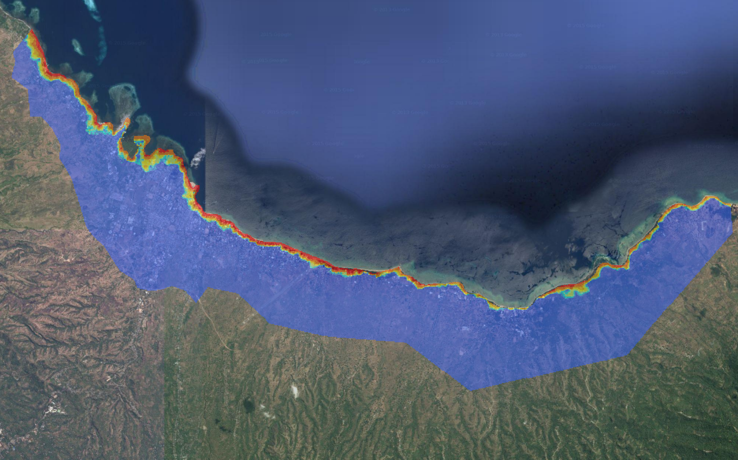
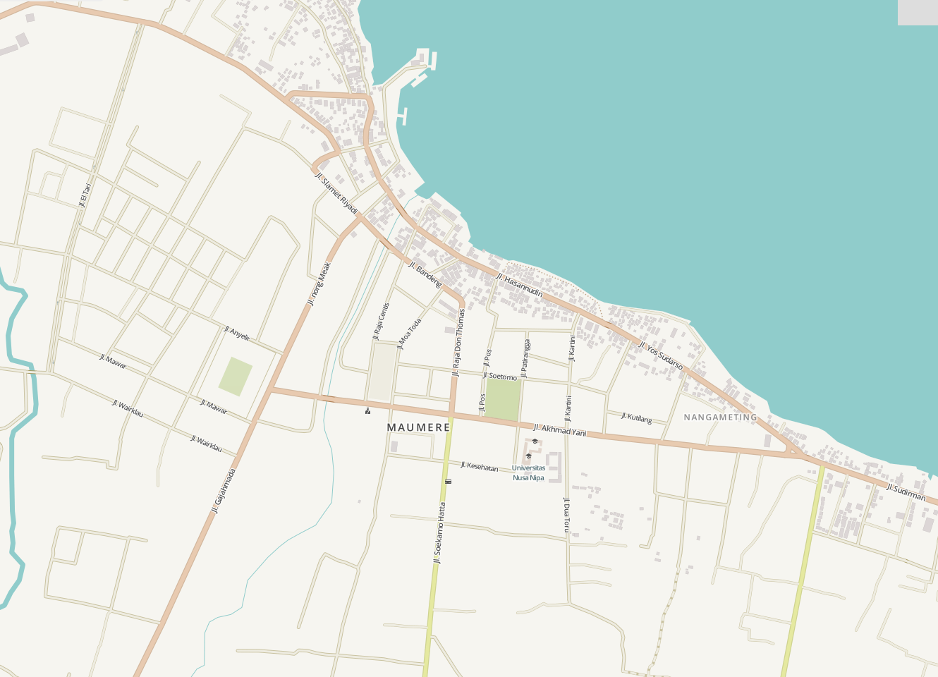
Maumere_Tsunami_WGS84.tif |
|
Tsunami in Maumere (Mw 8.1) |
|
Raster |
|
Continuous |
|
Single event |
|
Australian Government and Badan Geologi |
|
2012 |
|
|
|
Maumere, Flores |
|
In September 2011, the Indonesian government held a national exercise in Maumere, Flores. AIFDR and Australian Government assisted Badan Geology to develop a tsunami model for Maumere based on an Mw 8.1 earthquake. The Tsunami was modelled using open source software called ANUGA and elevation data from NEXTMap. The water depth is the maximum depth occurring across the entire tsunami event. For more information visit http://anuga.anu.edu.au/ and http://intermap.com/ |
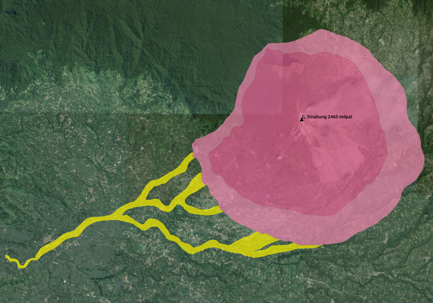
Volcano
|
Sinabung_Hazard_Map_2015_WGS84.shp |
|
Sinabung Hazard Map |
|
Polygon |
|
Classified |
|
Multiple event |
|
KRB |
|
Kawasan rawan bencana III - High; Kawasan rawan bencana II - Medium; Kawasan rawan bencana I - Low |
|
PVMBG |
|
http://vsi.esdm.go.id/gallery/picture.php?/63/category/7 (published map) |
|
2015 |
|
|
|
Sinabung |
|
This map contains information about the hazard level for each zone. It can be used to identify the potential impact. |
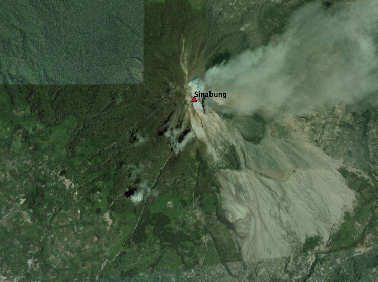
Volcano Point
|
Sinabung_Mount_WGS84.shp |
|
Sinabung Mt |
|
Point |
|
Classified |
|
Multiple event |
|
Name |
|
Sinabung |
|
PVMBG |
|
http://vsi.esdm.go.id/gallery/picture.php?/63/category/7 (publish map) |
|
2015 |
|
|
|
Sinabung |
|
The data shows the location of Mount Sinabung peak. |
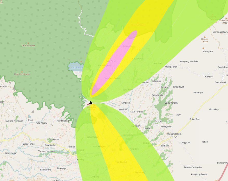
Volcanic Ash
|
Sinabung_Volcanic_Ash_1Feb14_WGS84.shp |
|
Sinabung Volcanic Ash |
|
Polygon |
|
Classified |
|
Single event |
|
KRB |
|
High; Medium; Low |
|
PVMBG - BNPB |
|
|
|
2014 |
|
|
|
Sinabung region |
|
The data show the spread of volcanic ash from Mount Sinabung during the 2014 eruption. |
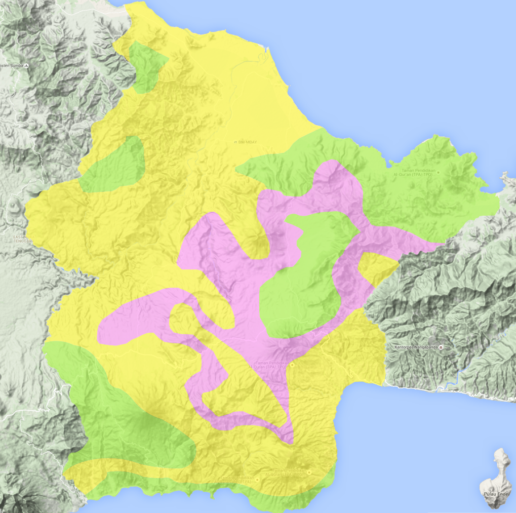
Landslide
|
NGK_Landslide_Vulnerability_WGS84.shp |
|
Landslide Hazard Zone |
|
Polygon |
|
Classified |
|
Single event |
|
KRB |
|
High Landslide Vulnerability Zone - High; Moderate Landslide Vulnerability Zone - Medium; Low Landslide Vulnerability Zone - Low |
|
PVMBG |
|
http://vsi.esdm.go.id/gallery/picture.php?/230/category/14 (published map) |
|
2009 |
|
|
|
|
|
Landslide vulnerability maps show the regions where landslides may occur. Topographic and landuse changes after mapping can change the landslide zone in the map. The high vulnerability zone is to be avoided for settlement areas or strategic infrastructure. If it can’t be avoided, build on the moderate zone, but detailed research is needed to avoid landslide happen. In moderate zone, detailed research is also needed when planning to cut the slope. |
Exposure data
Population
|
World_Population |
|
see table below |
|
Raster |
|
Continuous |
|
Count |
|
World Pop |
|
|
|
2010 |
|
|
|
ASEAN + |
|
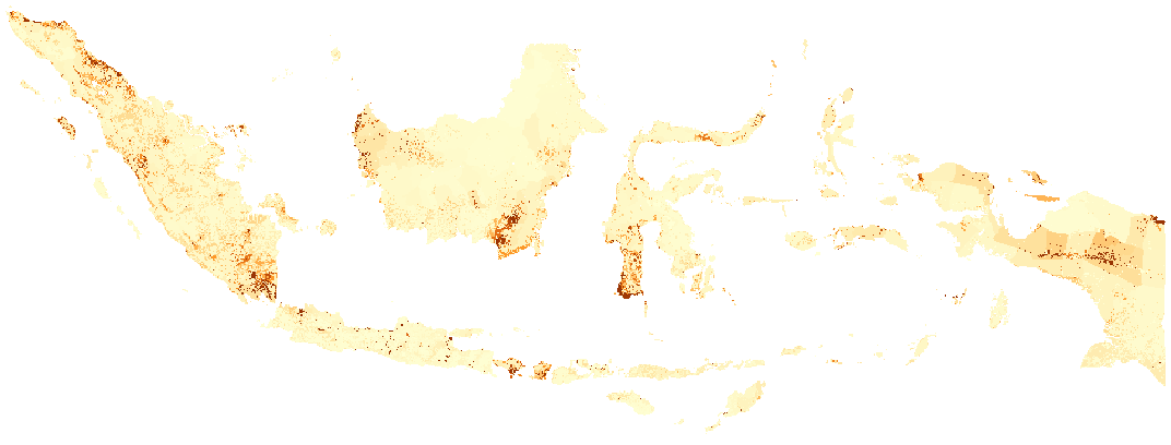
High resolution (1 pixel represents 100m x 100m, contemporary data on human population distributions are a prerequisite for the accurate measurement of the impacts of population growth, for monitoring changes and for planning interventions. The AsiaPop project was initiated in July 2011 with the aim of producing detailed and freely-available population distribution maps for the whole of Asia. This project has expanded as the World Pop project to include other continents. |
Training data provided:
Training Package |
Name |
Coverage |
Basic InaSAFE |
Jakarta_Population_WGS84 |
Jakarta |
Intermediate InaSAFE |
Jakarta_Population_WGS84 |
Jakarta |
Other Hazards |
West_Sumatera_Population_WGS84 |
Padang |
Other Hazards |
NGK_Population_WGS84 |
Nagekeo |
Buildings
|
OSM Buildings |
|
see table below |
|
Polygon or point |
|
Classified |
|
Type |
|
hospital, school, clinic, etc |
|
OpenStreetMap |
|
|
|
July 2015 |
|
|
|
World - incomplete |
|
OpenStreetMap is a collaborative project to create a free editable map of the world. Two major driving forces behind the establishment and growth of OSM have been restrictions on the use or availability of map information across much of the world and the advent of inexpensive portable satellite navigation devices. |
Australian Government has been working with the Humanitarian OpenStreetMap Team (HOT) since 2011 to pilot and train OpenStreetMap data capture in Indonesia. So far over 12 million buildings have been mapped. Some of the scenarios we use in the training materials are situated in Jakarta, Yogyakarta (Merapi), Sumatra (Padang) and Flores (Maumere).
Training data provided:
Training Package |
Name |
Coverage |
Basic InaSAFE |
Jakarta_Buildings_WGS84 |
Jakarta |
Other Hazards |
Padang_Buildings_WGS84 |
Padang |
Other Hazards |
Maumere_Buildings_WGS84 |
Maumere |
Other Hazards |
NGK_Buildings_WGS84 |
Nagekeo |
Other Hazards |
Sinabung_Buildings_WGS84 |
Sinabung |
Other Hazards |
Sinabung_Building-points_WGS84 |
Sinabung |
Each one of these areas has a different OpenStreetMap data collection methodology. Below the data collection methodologies used in Jakarta and Padang are explained:
- Jakarta:
BPBD DKI Jakarta (Regional Disaster Managers) and BNPB (National Disaster Managers) with assistance from Australian Government, the World Bank, UNOCHA, HOT and University of Indonesia, held workshops in each of Jakarta’s six districts in order to help village heads map their community boundaries and major infrastructure. Over 500 representatives from Jakarta’s 267 villages participated in these workshops and have mapped an impressive 6,000 buildings and all 2,668 sub-village boundaries (Rukun Warga-RW). For more information go to AIFDR Website
- Padang:
After the Haiti earthquake in 2010, there was a large effort to map Haiti through OSM. Coordinating this effort was difficult, and so Australian Government funded the creation of the OSM Tasking Manager. The OSM Tasking Manager is a web-based tool in which a designated area is easily divided into a grid, and individual users can select one piece at a time to quickly work together and digitally map the target area. The tool was first piloted in Padang, where contributors from around the world helped digitise over 95,000 buildings. However, the buildings are only footprints - an on the ground mapping effort is needed to record attributes about each building. The tool is now being used across the world to coordinate OSM mapping efforts. It is available at tasks.hotosm.org
Roads
|
OSM Roads |
|
see table below |
|
Line |
|
Classified |
|
Type |
|
types of roads |
|
OpenStreetMap |
|
|
|
July 2015 |
|
|
|
World - incomplete |
|
OpenStreetMap is a collaborative project to create a free editable map of the world. Two major driving forces behind the establishment and growth of OSM have been restrictions on use or availability of map information across much of the world and the advent of inexpensive portable satellite navigation devices. |
Training data provided:
Training Package |
Name |
Coverage |
QGIS Introduction |
Jakarta_Roads_WGS84 |
Jakarta |
Aggregation Data
Administrative Boundary
|
Administrative Boundary |
|
see table below |
|
Polygon |
|
Classified |
|
Kabupaten / Kecamatan / Desa |
|
toponymy of the area |
|
BPS |
|
|
|
2010 |
|
|
|
|
|
Administrative boundaries in Indonesia |
Training data provided:
Training Package |
Name |
Coverage |
Run Intermediate InaSAFE |
Jakarta_District_Boundary_WGS84 |
Jakarta |
Run Intermediate InaSAFE |
Jakarta_Subdistrict_Boundary_WGS84 |
Jakarta |
Other Hazards |
Sikka_Village_Boundary_WGS84 |
Maumere |
Other Hazards |
NGK_Villages_BPS_WGS84 |
Nagakeo |
Other Hazards |
Padang_Village_Boundary_WGS84 |
Padang |